Tuesday, January 29, 2008

Grand Tetons & Yellowstone


Wyoming Vacation of 2004


Howdy partner, I would like to tell you the story of our North West Wyoming adventure and about the wild beauty of the west that we explored. So, sit back and let old Rodeo Rick explain what might be difficult to believe. But believe you me it’s all true.

It’s best to start from the beginning so let’s start at the airport. The adventure started off with only me being taken from Pittsburgh to Wyoming on a silver-bellied gas-guzzler on June 19 2004. During the flight over our great country, I looked out the window and could see vast farmlands and snow caped mountains. So many farms covered the land like a checkerboard that it’s no wonder we feed the world. As the 757 approached the Jackson Hole Airport, the grandeur of the Tetons came into view and they were shockingly imposing. The jet flew over Jackson Lake and then the mountains. The tall jagged peaks loomed over the valley like sentinels guarding a mythical kingdom. It is no wonder that the indigenous Indian tribes of the west bivouacked at their base and the pioneers of the west followed.

After Alamo car rental gave me a brand spanking new Impala with only 14 miles on it, I drove off and was greeted by a big wooden sign that read, “Welcome to Jackson Hole the last of the old west”. It’s worth mentioning at this point that the Jackson Airport is quite small. It has a tented area outdoors used for waiting passengers of flights going out. It only takes about one or two flights at a time and very few during the week. It’s also located within Grand Teton National Parks boundaries. It might be something like what you would find in a remote part of Alaska.

As I left the airport area, I could see that the valley floor was carpeted with sagebrush and wildflowers as far as the eye could see. An endless variety and colors blanketed the whole area. Reds and yellows, lavender lupines and bright yellow sunflowers joined the aromatic sagebrush covering the fields. I had the feeling that I arrived in Oz. Then from the ground, I turned my gaze toward the Teton Mountain Range and was shell shocked at their mighty and imposing dominance. The majesty of there snow capped peaks gives testament to the great beauty of America. Photographs and western movies are woefully inadequate in delivering the same impact as they do face to face. The classic Hollywood movie “Shane” only gives an indication of their awesome beauty.

I drove into Jackson Wyoming to pick up some film for the camera. Back then I had a film camera the Nikon FM3A. No matter if you are a hobbyist, professional or amateur photographer a camera is necessary in this region. Jackson is a small western town with less than nine thousand residence. During the ride down, I continued to be stunned by the profusion of multicolored wildflowers and the beauty of the valley. It was of such a degree that I came dangerously close to smashing the nice new Impala into on coming recreational vehicle. The air was cool and fresh, and the aromatic scent of sage is ubiquitous. Jackson has everything one might need but is also relatively limited when compared to the built up areas back home. I found my film and had a quick lunch then returned to the Airport to pick up my cousin Eric.

Our weeklong quest was now joined and the adventure began exploring this wonderland right away. We traveled north on the main road and found a place called Swabachers Landing. A narrow dirt road leads down to the Snake River and offers unparallel views of the Tetons. A brightly colored yellow bird flew near and a coyote ran across the road during the trip down. The little yellow bird is a real jewel. Prairie Dogs scampered all around very active and busy or just having fun. After Swabachers Landing, we drove north to the Colter Bay Cabins. Along the way, we saw great herds of Bison marching across the planes with small newborn calves following behind.

Checking into the Colter Bay Cabins, we found them to be accommodating but basic. The cabin is a small box constructed of the indigenous lodge pole pine. I retrieved the tripod that I had sent by courier and we had dinner then ventured north toward Yellowstone. The road leading to the Teton sister National Park is unpaved and under construction. Major road construction occurs every year in and around Yellowstone so it is best to be aware of the locations. When we enter the park, we can see the rebirth of the fire-ravaged forest. While the charred remains of the lodge pole pines that once championed this forest stand naked and dead, new small pines about 6 to 8 feet tall blanket the base of each of them. The meadows and wetlands are picturesque. Many Elk graze along the road. We stop to take photographs of the Elk. After a short drive, we are greeted by the first geothermal feature at West Thumb Geyser basin. The sunset cast a soft orange glow over the steam that vents from the ground and with that, we returned to the cabin.

Sunday June 20, 2004

Early, before dawn, we got up and went to photograph Oxbow bend at sunrise. Oxbow Bend is a famous picturesque location along the Snake River where Mount Moran reflects into the waters below. Early morning sunrise is the best light to photograph this spectacular spot. Other photographers joined me at the location and we exchanged opinions on the best way to take the shot. When the sun did cast its mellow morning light on the mountaintop the camera shutters went off. A cool auburn slightly glimmers over the mountaintop at the instant the sun breaks. After that, it’s a race against time. A short time later we saw a huge bull Elk cross Leigh Lake at sunrise.

Along our way to Cascade Canyon near Jenny Lake, we saw a Moose in the willows feeding. I snapped off a bunch of shots and the Moose remained fearless throughout. Every time there is significant wildlife located a group of vehicles are pulled off the side of the road. If the wildlife is highly significant such as a black bear with cubs then it becomes a circus and park rangers do what they can to control the situation, as I will explain later in this work.

Cascade Canyon is a ravine that is traversed by a roaring mountain stream that is accessible by boat or a 3-mile hiking path. We decided to take the boat and climb up the mountain from its base along the lakeshore. The boatman warns of bear activity and that we should keep our distance if one is near. The hike is moderately difficult but well within the abilities of most people if paced well. The mountain air is thin and we found ourselves short of breath many times. This time we only climbed a short distance, about four thousand feet. Later in the week, we will climb the same mountain to seven thousand feet. The stream that flows down the mountainside is spectacular. I asked Eric where the water comes from and he replied that the water is coming from heaven like the never-ending springs of Valhalla. What a prophetic truth. It is a rushing torrent of Alpine snowmelt. During our travels through this unbelievable land, I stopped and wondered to myself if it’s all a dream and that I have died and passed into heaven. Nevertheless, the cool mountain air and the sent of pine brings me back and I realize that it’s actually happening.

After the hike, Eric and I went into Jackson to find a place for lunch and after asking around, we were guided to a great Mexican restaurant. The place is called “El Abuelito” at 385 West Broadway. The Mexican food is out of this world and comes highly recommended. We saw many Elk along the road as we drove down to Jackson. After lunch we went into Teton Village to ride the tram to the top of Rendezvous mountain about ten thousand feet up. The top is cold and windy and its great cliffs are fearfully steep. From the top, one can see the whole valley below and the great expanses of the sagebrush flats. It is truly a sight to see.

When we arrived back down at the bottom of the mountain we explored several back roads looking for wild life and that awesome photo shot. As I drove down a dusty road and continued to be shell shocked as to the wealth of wild flowers painting the ground I stopped to photograph a stand of large yellow sunflowers near a fallen tree. Eric proclaimed that it was just like a three-layered cake. “You have the flowers, the mountains, and the sunset all in one shot; it’s a three-layered cake”. I hardily agreed and took the shot. The location was down a road called Pilgrim Road. The back roads can be a bit difficult but the views of the mountains are rewarding to those that adventure down them. Also, during the early and late hours one will find greater numbers of wildlife down these roads.

We discovered that few concessions or amenities exist within the park and its best to take a cooler of food along the way to keep everyone happy. Gas can also be an issue and should be carefully monitored. The amenities that do exist within the park are a little pricey.

Monday June 21, 2004

We got up at three in the morning to travel up into Yellowstone and capture the Canyon Falls at dawn. It’s an 80-mile trip and off we went. As we approached the Hayden Valley inside Yellowstone, we had to stop because dawn was chasing the twilight away and we could see great herds of Bison gathered upon the rolling hillside shrouded in early morning fog. I had to take the shot while the chance was given me. When we got out of the car, we herd the call of the coyote and then saw two coyote cross the road ahead. Along the Yellowstone River Pelican drifted on the streaming water like white water rafters.

The Bison like to use the roads to travel on. As Eric and I approached the Yellowstone Canyon and started across the bridge, leading to the south rim road a huge Bison emerged from the pine trees and slowly made his stand in the middle of the bridge blocking our way. I backed up the car to allow him to cross then realized what a great shot it would make to capture a huge Bison crossing over a bridge. I got out taking some shots and the noble monarch advanced to the car. I stood behind the car door using it as a shield. Little else remained between me and the boss but the car door and an arms length. He looked at me with those deep dark eyes and I at him then he marched off. My heart pounding in my chest I got back in the car and gave the maker thanks. The encounter could have been much worse and several people each year are gored by bison.

The Yellowstone Canyon is a fantastic sight. The jagged rock cliffs are a bright shade of yellow and orange. The morning light plays on these cliffs and embellishes them with even greater magnificence. During this time of year, the waterfalls are rushing as torrents and the waterfalls at the canyons beginning were no exception. It was a wonderful sight and we took many photographs. Several professional photographers joined us at the falls. On our journey to the waterfalls, we saw two bull elk in full velvet. Its worth mentioning that the traffic was not as congested as I anticipated and in the early hours we had the whole park to ourselves.

Again, it is impossible to ignore the wildfire damage in Yellowstone. Thin burnt and branchless lodge pole pines are ubiquitous and scatter the landscape in countless numbers. However, young pines have spawned at the base of each charred tree and hold the promise of newness to come. In twenty years time the forested landscape of the park will ounce again be green and abundant with life. Regardless of the wildfire damage, the park remains a marvel and offers countless landscapes of majestic beauty.

We traveled the lower park loop and stopped at the Old Faithful area. Many geysers and geothermal features surround the Old Faithful area. Because Old Faithful is a national icon, everyone gathers around to watch it go off. The anticipation builds then suddenly, after a few false alarms, it fires off, heavy steam fills the air, and everyone snaps photos of it as fast as they can.
Dinner at the Old Faithful Inn was nostalgic. The whole structure of the Inn is constructed with indigenous timbers. It’s a sight to see. The main gathering area is wide open with a huge stone fireplace and a very high ceiling. It gives one the feeling of going back in time to the old west.
We traveled around to find a good sunset spot and after capturing a few shots, we returned to the Cabin down south at Colter Bay.

Tuesday June 22, 2004

We made a change in plans because the sky was clear as crystal and the day would be perfect for mountain photography. Therefore, we stayed in Grand Teton National Park to take advantage of the opportunity. At dawn, we returned to Oxbow bend and created more artistic images with the camera. At Oxbow Bend Otters played in the river and Pelicans made a show in the distance. We then drove down to Leigh Lake to capture the reflections that are cast on the waters. This is a perfect location for any photographer to be during the early morning. Then we traveled down a small road named Wilson Road that connects Moose Junction to Teton Village. Along this road is wetlands and marsh that the Moose are attracted to because of the willows that grow there. Well, while we drove down the road we suddenly saw several vehicles pulled off to the side of the road. A baby Moose was gently feeding amongst the willows. We went down into the wetland area and took all kinds of shots. The Moose was unfazed by our presence. It might have been dangerous if mother came around but we saw no sign of her. We accomplished all of this before 7:30 in the morning.

Then we doubled back on the main road to Swabachers Landing and got some great shots near Snake River Overlook where Ansil Adams created his famous black and white image of the Teton Mountain Range with the winding Snake River as a foreground. Around 9:30 in the morning, the sun turns the air hot and dry. The dry air can cause some trouble if not prepared for it. We used DEET to keep the bugs off and it works well.

Later in the afternoon, we returned to Yellowstone. If you do not travel into the park early, you can expect lots of traffic as we encountered. After getting past the traffic, we explored the many geyser areas and waterfalls. Places like Mud Volcano, Sulphur Caldron, and Fountain Paint Pots. Keepler Cascade is not worth stopping at because the view of the falls is obstructed. We saw a lot of wildlife as we drove around, Mule Deer, Elk, Bison, Coyote, and several different birds. At this point in the trip, we did not yet see any bear but hold on to your holster cowboy the story is not over until the black bear growls. At a place called Niez Pierce, a dead Bison was in the field and left a strong odor. Some folks gathered around the place hoping a wolf or grizzly might stop by to check it out.

We decided to drive all the way up to Mammoth Hot Springs and go into the Lamar Valley. Along the way, we encountered a multitude of vehicles pulled off to the side of the road and forest rangers controlling traffic. Off in the ravine to the side of the road was a black bear with two playful cubs. What a sight to see. We both got out and started shooting all kinds of photographs. Many professional photographers lined the road and some people just sat there enjoying the sight. On the way back we saw another black bear in the woods more distant from the road. What a day.

Wednesday June 23, 2004

We got up with the birds once more and drove directly to Swabachers Landing. As we approached the beaver lodge on the water, we saw that a Moose was feeding in the nearby willows. It was another three-layered cake, the mountains, the moose, and the beaver lodge all in one shot. National Geographic could not ask for more. What a perfect start to the day. Eric and I had an outdoor breakfast at the Chuck Wagon near Moose Junction overlooking the mountains.

I went to the meeting area to go on the Snake River Float trip. The float trip was magical. The big stones that cover the riverbed are all smooth and rounded. The crystal clear water let me see down to the bottom and when the sunlight hit the stones, I could see that they are a mosaic of colors. It almost seems too good to be real that such a riverbed would be like that. However, the float trip guide explained that the stones were created over thousands of years through glacial action on them. Our guide was very informative and gave use quite a lesson about local history. During the float trip we past under an American Bald Eagle and her nest. Two fledgling Eaglets looked out over the top of the nest. The mother was carefully protecting the nest and her children. The air is filled with the fresh scent of pine while the float raft meanders down the river.

It was about this time that all the running around caught up with us and we just could not go on without rest. Eric and I went into town and had a second helping of the Mexican food then returned to the cabin to nap between two in the afternoon until six in the evening. I slept like a baby. The alarm sounded and we got up to tackle the back roads once again. I looked at the mileage and was shocked to see that we put on over one thousand miles. In the backwoods, we spotted a huge Elk cow.

After our nap, we went to the top of Signal Mountain. Along the way, I could not help but stop and take photographs of the Wyoming State Flower, the Indian Paint Brush. Indian Paint Brush is a bright red flower that is not as common as many of the others that carpet the landscape. At the top of Signal Mountain, you can see a great deal of the valley below and with binoculars you can see great herds of Bison and Elk along with Mule Deer and Pronged Horn Deer. The valley view is spectacular. Much to our amazement a sage grouse walked along the roadside very slowly and allowed us to take its photo with little care.

Thursday June 24, 2004

We got up late today and at 6:30 in the morning we started out to find a power breakfast. The best place to eat that we found was the Signal Mountain Lodge Restaurant. After a good cup of coffee and some grub, we decided to hike up Cascade Canyon one more time. This time we are going all the way to Hidden Falls and seven thousand feet up. The waterfall is visionary and mythical. Alpine snow melt cascading over a steep cliff in unreal amounts. The spray was getting everyone around the base wet and a fine mist filled the air as it does at Niagara Falls. I made my best attempt to capture it on film considering the conditions. Suddenly everyone started to look into the trees at the base of the waterfalls and there in the trees was a huge Moose feeding. We returned to the bottom of the mountain and took the boat ride back over Jenny Lake. The cool mountain air embraced us along the way.

We stopped a moment to thank God for such a wonderful trip and to remember that love of country and flag has nothing at all to do with government.

Our last trip to Yellowstone National Park was blessed with beautiful scenery and lots of wild life spotting. During the ride up into the other park, we saw a Bull Moose feeding in the distance off the road. As we traveled down to the Fishing Bridge area of Yellowstone, we explored many geothermal attractions like Dragons breath and Dragons mouth steam vents. The road leading to Steamboat Point had a good number of wildlife, such as American Bald Eagle, a small herd of Bison, and a Brown Bear on the move with park rangers policing the situation just as before up in the Lamar Valley. All of these wild animals were in close proximity to each other. I got out of the car and chased down the road to get some shots of the brown bear. The rangers stopped me after a while. What an excellent day.

Friday June 25, 2004

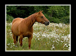
Sleep in today then had a two-hour horseback ride. The wranglers at the stables were very professional and the trip took me to locations you just won’t see unless you hike back to the same area the horse trail is. Spectacular views of the Teton’s are all over the place during the ride. Two hours was a little too long and my hindquarters and knees complained rather forcefully at the end of the ride. I got some nice shots
of the wranglers and horses. The horse I was on was named Comanche and it was well behaved.

Back down in Jackson a nice girl told us to have lunch at the Cowboy Bar. I was not going to go to the Cowboy Bar because I didn’t think it had food. Well, when we got into the place it was more like an old west museum than a bar. The whole place is western to a tee. The bar stools are saddles, western collectables, like guns and cowboy clothing and spurs are on display in showcases. The whole place is decorated with western art and just had a great feeling about it. It is a must see for anyone traveling through town. The food is not bad and the drinks are good.

The Gross Venture Pass road outside of Kelly is very scenic and along the way is a hot springs swimming area. It’s free to the public and on public lands. The water must not be too hot because all kinds of people were down in it having a good old time. When we returned down the road, we went over to Antelope Flats Road and hundreds of Bison congregated on the flats. More Bison than we had seen during the whole trip. Many had calf’s following behind among the wildflowers and sagebrush. The famous barns from an old abandoned ranch set off the view tremendously. Eric and I took many photographs.


Saturday June 26, 2004

Our last day in Gods country and we wanted to stay but had to go. Eric and I had our last breakfast under the mighty towers of the Teton Range at Signal Mountain Lodge. Then we drove down the park road to the Airport. I looked down at the mileage, saw 1580, and could not believe it but then again we did do a whole lot of driving. Our flights left at close to the same time and back home we flew.

In conclusion, I must say a few last words. It is beyond my ability to adequately explain the breathtaking beauty of this land. The mountains are arresting and megalithic. The endless fields of wildflowers are mind-boggling, as if a huge aircraft flew over and dropped billions of flower seeds. The wildlife is so abundant that at almost every turn one will encounter some kind of wild animal. The air is aromatic and clean with the scent of sage and pine. The roads are clean and unpolluted as if people know that this is sacred land and irreverent to litter it. I can only say that, if possible, every American should see and enjoy this part of our National Heritage.

Saturday, January 26, 2008

Great North West Vacation

Great North West Vacation of 2005


June 24 2005

Upon my arrival Eric meet me at the airport and we were off and running.

Eric’s family has a very nice home that was comfortable and inviting. The dog and cat loved me, as it should be with all those I encounter.

After being acclimated to the area, Eric and I explored the Columbia River Gorge vicinity on the Oregon side of the river. This realm is blanketed in lush green forest and waterfalls abound. As we took every opportunity to stop and admire each waterfall we encountered a foolhardy dare devil whom base jumped from the top of one of the more spectacular falls. This was a big surprise because we had no idea that he was up at the top ready to do this at the time it occurred. It was a very short distance for base-jumping and if his shut did not deploy perfectly it would have been a bad time, but everything worked out.

The Columbia River Gorge is very dynamic and so many features of its beauty would require many years to fully appreciate. However, we only had a day and we did the best we could. We had lunch at the base of the most impressive falls in the region; Multnomah Falls. This ostentatious waterfalls cascades down a steep precipice in two tears creating a dazzling picture. The hiking path leads to a bridge that spans across the bottom of the first tear. The immensity of the primordial forest was too great to comprehend with my inadequate intellect. Great fur trees and red cedar tower above, clothed in a gracefully woven patchwork of moss.

Our exploration of the Columbia River Gorge area on the first Saturday after my arrival put us one day ahead of schedule. Therefore, on Sunday we made it a day getting to the coast. Along the way to Canon Beach in Oregon, we found many interesting farmlands and the countryside was blanketed in wildflowers. We stopped on Highway 26 and had breakfast at the Elderberry Inn and Restaurant. This was a lucky find, as the breakfast was very good and much to my surprise homemade strawberry jelly was brought out for our enjoyment. This jelly was so good I ordered a pint to go. We found Canon Beach to be quite a tourist town and access to the famous Hay Stack Rock out on the beach is limited. Eric and I stopped and had lunch at a new establishment close to the beach.

Just outside the tourist town of Canon Beach is Ecola State Park. The view of Canon beach from the viewpoint area inside Ecola State Park is very pleasant and many postcard photographs one might see of it are captured from this park area. During this time, the climate was cool and overcast with a lite drizzle most of the day. We spent the day in and around the coastal regions of Oregon then made our way to the town of Astoria to lodge overnight at the Red Lion Inn.

On Monday morning, we got an early start and had a complimentary breakfast at the Inn. We crossed over into Washington State again and proceeded up route 101 north along the coast. Fog and drizzle accompanied us during our drive. An engaging observation during this section of the trip is that brightly colored Foxglove grows wild along the roadside in abundance. Eric and I observed a few Elk in fields along the way but not in the great quantity that we had hoped.

Sol Duc Falls

At Southbend Washington, the Oyster harvesting industry is very big. We stopped and I photographed some of the Oystermen at work. They load huge traps onto the boats and sail out to gather others then place the empty ones. It was fascinating to see the operation in action.

The lumber industry is also an enormous part of the Northwest economy. Countless logging trucks race down the roads with tons of logs. The clear-cut areas are replanted with new trees and like a colossal farm; the hillsides and woodlands are harvested according to a specific schedule. This schedule is posted along the roadside.

Highway 101 winds its way up along the coast and inland going to Olympic National Park. We stopped at Ruby beach and found many tidal pools with starfish and sea anemone trapped on the beach. The sea stacks are numerous and the beach is covered with a mosaic of rainbow painted rocks. While we left the Ruby beach area, I noticed a sign indicating the tsunami evacuation route.

Traveling up route 101, we stop at the Quinalt Rainforest and then the Hoh Rain Forest. Both rainforest are stunning but time did not permit us to investigate them fully. Countless old growth trees dwell within this forest. These Douglas fur and Western Red Cedar are thousands of years old and tower high above creating a canopy. Bulky mounds of green moss drape over everything. Eric asked a person if they knew the location of “The Hall of Moses” because I told him such a place existed inside the rainforest. The funny thing was that the true name of the place is “The Hall of Mosses” so we all had a big laugh and I will need to go back to school and learn to read again.

Upon arriving at Lake Crescent Lodge inside Olympic National Park, we checked in and found our room. The lodge is old and well preserved in its age. The main sitting area has a large fireplace with a stone hearth. A great Elk head hangs on the wall above the fireplace and Native American Indian Mask’s decorate the lobby all around. After settling in, I had dinner inside the lodge restaurant. The restaurant is a four-star gourmet experience. The mouth-watering crab cakes were out of this world and I wish I had the recipe for them. The roast duck was charmingly presented and smothered in a sophisticated sauce consisting of truffles and Elderberry wine. I was very happy with the dinner and the surroundings of the celebrated lodge. Lake Crescent is pristine and encircled with lush green mountains. The lake water has an emerald translucence that reminded me of ocean waters I saw around the Caribbean Islands. Outside the lodge, the air is filled with a commanding scent of cedar and pine.

Although the lodge offers top-notch cuisine at its restaurant, less affluent accommodations for food and not to mention gas are few and far between. One might find themselves trapped inside the area without gas if not careful. The lodge does not supply ordinary hot dogs or hamburgers, so it’s best to be prepared for this when visiting. While on the subject of convenience, it is also worth mentioning that many of the few stores or gas stations that are around will close at very inopportune hours, this too should be well thought-out when visiting.

On Tuesday morning, it was an early start going to The Heart of the Hills location. This region of the park is accessed through the only city near the north part of the park; Port Angeles. The accent up to The Heart of the Hills is 17 miles. The road going up is unforgiving, with steep cliffs and drop offs along the side. Several switchbacks make the drive very interesting to say the least. Along the way, wildflowers dazzle the eye with scarlet Indian Paint bush, violet lupine, Shasta daisy, and immeasurable other colorful species everywhere. The wildflowers cover the hillsides with endless rainbows. The mountains rise into the clouds and lush forests of pine blanket them filling the wind with their cool scent.

At the top are a few buildings and a spectacular view of the Olympic Mountains. A hotshot photographer with an 8x10 box camera was set up photographing the spectacle. The snow caped mountains shimmer in the distance while meadows blanketed in early blooming flowers extend out in front of you. I proceeded to hike down one of the trails and was greeted by a dazzling array of multicolored flowers and grand views of the mountains. The fresh mountain air was cool and the visit was all that I could hope it would be. A park ranger informed me that the wildflowers were near peak. A male deer appeared out of the trees and slowly meandered its way towards me without a care in the world. Its new antlers were in full velvet as it grazed upon the meadows.

Before we went to Hurricane Ridge, we stopped for a short drive in the Elwaha Valley and it was very nice during the early morning hours. Fog and mist embraced the forest and a mountain stream follows the road along the way. Huge banana slugs are everywhere and difficult to avoid.

After our return to Port Angeles from Hurricane Ridge, we traveled to a place known as Deer Park Road. This road is nice going into the park and many deer are in the area. A mother crossed the road in front of Eric’s truck and two fawns followed her into a patch of snow-white wildflowers. Both Eric and I attempted at capturing and image of the sight but fell short. Such is the story of my life, nevertheless on with the show.

Deer Park road becomes an unforgiving and treacherous dirt path that ascends into deep-forested woodlands. This journey into certain doom became too much for my frail heart and we decided to turn back. I was sure that I saw a sign that said, “Witches castle this way, I’d turn back if I were you”. Therefore, we did just that.

At this point, we decided to travel the long road to Cape Flattery. The ever-present lumber trucks kept us alert as we made our way to the Makah Indian Reservation. The harbor inside Neah Bay is filled with old fishing boats that serve as an outstanding backdrop to the feeling one gets around this place. Sights such as this enabled Ernest Hemmingway to write his inspirational novels. Bald Eagles are much more common in the Northwest than back out East and we saw several fishing around Neah Bay. The views from Cape Flattery are superb. A lighthouse stands alone on top of a huge rock out away from shore and the mist covers everything. It gave me the feeling that I was admiring a Winslow Homer oil painting. The ocean waves crash over the rocks and sea gulls take flight in great clouds with their familiar calls.

I am uncertain weather the journey out to Cape Flattery was worth it but have no regrets as it is a wonderment to view the Pacific at its best. On our way back, Eric spotted an Owl sitting on top of a signpost along side of the road. We stopped and I got out photographing it. It did not move as I approached closer but then took flight. Our drive back was long and when we arrived at the lodge, I made sure to get a drink at the bar inside the lodge. Food was unavailable anywhere during this time. Everything shuts after five or six in the evening. The bar tender was kind enough to find a bowl of seafood chowder for me in the kitchen. This chowder is incredible and I gave the bar tender a tip which reflected my gratitude.

On Wednesday morning, Eric and I started out to the Rialto Beach area of the park. As we traveled down the road, the wild Foxglove stood in great numbers along the way. We stopped to see a black bear feeding in the distance. At the Rialto Beach, location is another Indian Reservation and a small village called La Push. Although Rialto Beach is a nice place to visit, we did not arrive at low tide, or if we did, did not know where to go in order to see the Sea Stars and Sea Anemones. The beach is covered in multicolored smooth stones. When the stones are wet with water the color shines like costly gems. The shore is embellished with driftwood and this adds to the picturesque ambiance of the place. Ruby beach was better than Rialto beach and if time will not allow both, go to Ruby beach.

After Rialto Beach, we backtracked to Sol Duc Falls. This area of the park is very nice and well worth the time spent. The old growth forest that surrounds the main attraction is lush and full of singing birds of all types. The easy path guides you down to the waterfalls. A bridge crosses the cascading stream allowing you to look over it to witness the marvelous sight of three waterfalls flowing into a great gorge. Each of the three falls is formed from one alpine mountain stream flowing from the Olympic Mountains. It was quite an enjoyable walk down and back.

We returned to Lake Crescent Lodge in time to have dinner at the affluent restaurant again. This time I took it easy on the wallet and had some fancy chicken dish. As everything else, this too was scrumptious. After dinner, I sat in front of the fireplace and relaxed in a big overstuffed chair. I talked with a fellow photographer and exchanged stories of the Northwest experience. The evening was topped off with a pictorial sunset behind the mountains that glittered scarlet and chartreuse over the lake.

On Thursday morning, we got another early start and headed out to Mount Rainer National Park. I had little knowledge at this point that Olympic National Park served as an appetizer for Mount Rainer. Along the way, we stopped at several attractions such as but not limited to the Dungeness Wildlife Refuge, Dosewallips, and some Hood Canal oyster operations. The wildlife refuge did not open its gates until 7am, which made us wait for it. The area is interesting but was uneventful and our stay was short. As we made our way to Mount Rainer, numerous firework stands litter the roadside. Native Americans of the Northwest sell fireworks in small roadside shacks to make a few dollars. It was close to July 4 and Washington State allows fireworks during the week around this time.

When Eric and I arrived at Mount Rainer, we passed our lodging accommodation in a small town named Ashford just outside the park and drove directly into the park. At the Nisqually entrance is a place called the Gateway Inn and it looks like a very nice place to stay. Our intention was to drive up the road that leads to a place aptly named Paradise. As we ascend this mountain road, the vista becomes more and more spectacular. After a little while, we suddenly realized the gas level in the truck was precariously low so we abandoned our quest to reach Paradise and returned to Ashford for gas and the evening. We stayed at a place called Whitakers Bunk House and it looks nice from the road but the rooms are small and stuffy.

Early Friday morning we set out to cover as much of the park as possible. The mountain was blanketed in clouds but that failed to slow us down. We travel the road to Paradise and this time we made it. What a breathtaking place. I cannot find the words to satisfactorily describe this heaven on earth. Wildflowers feed the numerous deer that frolic in the meadows without a care. The snow caped mountain is towering over you while the fresh scent of mountain pine fills the air. It all comes together here and we returned to this place several times during our visit. In the evening as the sun retreats, its warm rays bath the mountainside. In the morning, mist and clouds create a sublime mystery that touches the soul.

This is Late June and the buds of what promised to be a dreamlike display of lupine and Indian paintbrush along with countless other flowers were abundantly clear. From what I saw, it looked like mid to late July would have been the perfect time to witness this impending kaleidoscope of color. Nevertheless, the early flowers offered a very rewarding show in there own right.

Unlike the road that leads to the spiritual paradise, the roadway that leads to this Paradise is unforgiving. A good amount of the driving can be challenging. However, along this road is unparalleled beauty that for those determined enough to witness will not soon forget. All and every turn out should be used to rest and view the majesty unfolding before you. God, how I love America.

We continued to the town of Packwood to have breakfast at a nice little restaurant just inside of town. We then go back into the park for a stop at a place called “The Grove of the Patriarchs”. This is a highly recommended place to visit while in the area. The hiking path is very easy and the wildlife, trees, and streams, are enchanting. I stopped countless times to photograph trees and then I found the stream. This small mountain stream is filled with small rounded stones like those found at the ocean. Each one is a different color and when the water flows over them while the sunlight glitters across it, they sparkle like gold and diamonds. It reminded me of the rainbow of glacially formed stones that lay upon the bed of the Snake River in the Teton’s.

After spending much too little time at the Grove of the Patriarchs, we traveled to a place called Tipso Lake. The scenic view of the mountain from here is priceless. The snow-topped mountain reflects into the lake creating a perfect picture postcard. The insects are brutal around the lake but a little DEET goes a long way. If you are doing photography, be very careful with the DEET because it’s greasy and can cause some trouble.

Upward and onward to another mountain top location called Sunrise. The road trip to this place is treacherous but when we arrived, unquestionably, worth it. At Sunrise, the view is galactic. We had a small bite to eat at the Sunrise visitor’s center and explored the area. This area being at a higher elevation had a little more time left before wildflower activity. Some snow was still on the ground. It would not be worth the effort to get here, in my opinion, until after late July or so.

On our way back to Ashford, we stopped again at Paradise to take advantage of the evening light.

Saturday morning we got another early start and stopped a third time at Paradise; just in case my soul never makes it, I can say my body did. Eric and I then stopped again at the same place in Packwood for breakfast before heading back to Vancouver. Along the way back home, we made a detour to visit Mount Saint Helens National Monument. As in Mount Rainer National Park, signs indicating the volcano evacuation route are posted along the road. The weather was unkind and kept the volcano hidden from view. Wild huckleberries grow along the roadside. The regeneration of the woodlands around the volcano is interesting to see. The forest service and lumber companies worked to replant endless numbers of fur trees. We did see the lower section of the trench that was created from the explosion. The visitor’s center is focused on educational exhibits and programs for the public.

When we arrived in Vancouver, it was agreed that the family and I would all go out to dinner and celebrate another day of living. It was an enjoyable evening. Eric and I had a great time adventuring around the great North West. Appreciating its immense beauty would require a lifetime.

Colorado Vacation 2006

Colorado Vacation 2006


Experiencing the rocky mountains of Colorado during the peak of autumn color captivates the soul with a sublime fulfillment difficult to explain. The alpine landscape and mountain vistas extend to the outer limits of inspirational beauty.

During this adventure, over 700 digital image captures were shot and over 1700 miles traveled. Each day began before dawn and ended after sun set. The adventure was free of inclement weather. Being blessed with such good weather was but one of the gifts bestowed upon this rocky mountain odyssey. Around every bend and over every mountain pass banners proclaimed the seemingly endless boundaries of national forest lands and wilderness.

Colorado embraces a dynamic range of landscapes. Beautifully forested mountains blanketed with lush evergreens and rugged canyons of burgundy that are dotted with cactus along with other succulent flora are but a few examples.

September 23, 2006

After an uneventful flight to Denver that did not cause any ear pain, I proceeded to procure my rental vehicle and drove to Boulder. On the far west side of Boulder along route 36 is a Mexican restaurant named Sol Azteca. The food here was outstanding with extra emphases on the top shelf salsa. After indulging a beef burrito with the works, I hit the road to Estes Park outside Rocky Mountain National Park.

Estes Park was very crowded with many tourists and is much like Gatlinburg Tennessee just outside Great Smoky Mountain National Park in that it has many shops and accommodations just outside a National Park.

Route 36 is picturesque and is a great way to approach the vicinity from the depressing area around Denver.

The entrance fee to RMNP is $20 and is good for the week. It was only a very short time after entering the park that the Elk activity became conspicuous. The Elk are in full rut and the bull’s racks are huge. One can here the bugling calls of the bulls everyplace. I never saw so many Elk in one place before. Many harems scattered across the park are well watched over by the bulls that possess them.

After an initial exploration of the park and its impressive surroundings, I found the first over night accommodation just outside the park entrance station in Estes Park. The Alpine Trail Ridge Inn is relatively comfortable and very close to the park. It is a well-placed lodging in that a welcoming “mom and pop” restaurant is just a few feet away. The Sundeck restaurant offers a down-home menu of good food including home made soups, pies, and its famous fried chicken. I had the fried chicken and almost everything comes with a side of cranberry sauce that is full of whole cranberries. It was reminiscent of a Thanksgiving Dinner. Vic and Colleen Hoerner run the place and make sure each customer is taken care of.

September 24, 2006

The day began with a predawn ride to Bear Lake. The refreshing scent of pine fills the alpine air. At 9500 feet, the air is noticeably thin and cool. Snow glazed the rocky peaks around the lake like powdered sugar. When the sun illuminated the region the lake and its splendor was fully revealed. No photographic skill that man possesses is adequate to convey the magnificence and presence of this place.

When returning down the mountainside a rushing alpine stream, which could not be seen during assent, was now apparent. Cascades of translucent water musically tumble over huge boulders. Words are woefully futile in there aptitude to explain the thrill of being surrounded by the mountains. The land here is too dynamic to understand without walking through the fields and breathing the wind caressing the evergreens that blanket them.

I spent the afternoon climbing, by car, to the highest permissible point in the park along Trail Ridge Road. The road was closed from Rainbow Curve to Grand Lake due to snow and ice. The view at this height is imposing as the mountains command ones full attention. Continuing to explore the park in bright sunshine, I stopped for an ostensibly short time to reflect on it all.

After a small diversion to have lunch at the Sundeck, I returned to Moraine Park and never saw so many Elk and photographers jammed into one area in all my born days. Two Elk fought and locked horns in serious battle. The photographic opportunities are endless inside the park. A park ranger chased me away from getting to close to a bull elk and later in the evening I came close to hitting an elk cow about to walk out onto the road.

Looking back, I should have devoted at least one additional full day for Rocky Mountain National Park.

September 25, 2006

Before dawn, the journey continued down route 7 outside the park. The morning was frosty and countless Elk bugled in the mountains and fields along route 7 just outside Estes Park. The bugling echoed off the mountains on all sides.

Copland falls near the Wild Basin region of the park was a vigorous early morning hike in refreshingly cold air. This area of the park is not well advertised and sits alone away from the heart of the park as one approaches the Peak-to-Peak highway. Copland Falls trailhead is at the end of Wild Basin Road. The waterfalls are a spectacle of nature.

The goal today is reaching Snowmass Village outside Aspen to the west. Peak-to-Peak highway is a nice drive and many stunning views are along this route. Interstate 70 is a nice drive as well because the mountains are everywhere along this interstate. They make one feel like a tiny ant as they tower above. Because the Eisenhower Tunnels had construction delays, the alternative was traversing Loveland Pass Road. Driving up to the top, the realization as to why so many choose to fight the traffic delays rather than take the pass became horrifically apparent. Let us just say this was a very adventuresome part of the trip. Steep mountain passes without any guardrails to prevent a dreadful deadly crash are not for those with acrophobia. At 11,900 feet, the top offers a breath taking view in all directions and snow boarders along with skiers populated the summit. A little girl was building a snowman and enjoying a day of winter fun.

Continuing my trek to Snowmass Village, I noticed people with ski poles while they hiked across dry ground. I also noticed that the evergreens health was not good in some locations while in others it was flourishing. The trees have been attacked by a pernicious insect that is killing some evergreens. On the other hand, many are doing very well and some that look sick from a distance are actually burdened with abundant pinecones covering them in shades of brown. An example of the woodlands plight is that the Dillon Lake area had many dead or sick trees while the Roosevelt National Forest was lush and vibrant.

At the junction of route 24 is the small town of Leadville and everyone in town must be in a contest to see who can win the most decorated and colorful house contest.

Many Aspen trees have lost all their foliage in the San Isabel National Forest but the evergreens are healthy. Route 91 going south from route 70 into the town of Leadville is out of this world in beautiful scenery. This is unquestionably the best route to take going to Aspen. After a good snow, it’s even more extravagant. Independence Pass, along route 82, is a perilous mountain pass that is worse than Loveland Pass and its summit is 12,100 feet. It is an unforgiving assent to the top. Although the pass is challenging to the weak at heart the dramatic beauty is like a fantasy film.

As one approaches the town of Aspen on the decent, the Aspen trees become glorious and the smell of pine is exhilarating.
While traveling to Aspen, the lack of road signs was very apparent. Road signs are few and far between.
In Aspen, those that ski will roller blade with ski poles in each hand to simulate skiing.

Proceeding to Snowmass Village I made a short diversionary trip to explore Ashcroft Ghost Town. On the west side of Aspen is a roundabout and an impressive stone church. The road above the church leads to Ashcroft Village the road below the church leads to the Maroon Bells Wilderness area. Ashcroft village was a disappointment and not worth the time to visit.

Snowmass Village is a short jot west and upon arrival; the assessment is that the village is a work in progress. It was designed to have all the needed conveniences with housing all under one roof. The Snowmass Inn was not as welcoming as I had hoped but was not too bad. Parking at the room location was disallowed making it inconvenient. The air is noticeably thin and one must often catch a breath or two.

The wind, sun, dry air, but most of all the endless beauty caused my eyes to become bloodshot. I can say that over a larger range the Rocky Mountains are more dynamic and colorful than the Grand Tetons. Out in the wilderness the night sky is profuse with celestial bodies that give the soul a feeling of deeper meaning. Always take the time to look up into the night sky when it is clear while out in the wilderness.

September 26, 2006

The day began before dawn and the frost of old man winter filled the morning air. Arriving so early at the Maroon Bells Wilderness area one does not pay an entrance fee. After finding the parking lot, I followed the lead of several other photographers already parked and prepared to work. The hike to Maroon Lake is very short, about 25 yards. Then suddenly the glory of the Bells appears in front of you. The reflection in the mirror like lake was perfect and the still quiet made it even more astonishing. In the twilight before dawn, the full grandeur is not yet revealed but as the sunbeams caress the rocky crags and the snow is bathed in the light of dawn its arresting power becomes evident. Holding back tears, I set up my camera equipment and conversed with the other photographers. At the edge of the lake, over 25 photographers set up to shot the famous landmark. All where more than happy to give tips and hints on the best approach to capturing such magnificence. As the light grew, the entire area looked like heaven had fallen upon the earth. Then I realized that my paltry photographic equipment and feeble skills where no match for this goliath that stood proudly in front of me. I could only make a sad attempt at capturing what unfolded before me as best that I could.

After doing the best I could at the Bells my journey continued through Kebler Pass and to Crested Butte then looping around back to Snowmass Village all in a single day.

Traveling west on route 82 to Carbondale I stopped at the Red Rock Diner for breakfast and it was very nice. The waitress was dressed up like an old west call girl and was very nice. I feasted upon sunny side up eggs, home fries, and country sausage with a rich cup of coffee to wash it all down.

The road then becomes route 133 south and after the Marble exit 133 develops into a much more mountainous and alpine spectacle. Around every turn was a mosaic of golden splendor. The Aspen trees turn color in groups because each grove is a single living organism. Therefore, in some locations the color is not fully turned while in others it is peak or past peak. This area on route 133 was at peak color.

Just past the Paonia Reservoir off to the left is Kebler Pass Road (County route 12). The reservoir was dry as a bone. This area was at about 50% color but many areas had full color and the landscape is stunning. In another week, it will be peak color but mountain pass roads can be closed as early as mid September from snow.

Crested Butte is another colorful small town nestled in the mountains. A hippie community lives in an area known as Gothic very close to town and obviously has had a great deal of influence on the culture in town.

Traveling further to the south on route 135 into Sapinero I encountered a bighorn sheep crossing the road. The Sapinero region of Colorado has a much different landscape and geological features than what was formally seen. The Black Canyon of the Gunnison is aw inspiring. I saw only a small section of it but that was enough. Route 92 hugs the edge of the canyon and is adventuresome to drive. At this point, I realized that too much distance was to be covered in a single day and I had to move fast against the setting sun. One feels so small in the presence of such a grand and commanding countryside.

September 27, 2006

This morning the goal is to travel to Ouray Colorado. The route will take 82 west, 133 south, 92 west, 50 south, 550 south into Ridgeway and then to Ouray. It is a 4-hour trip from Aspen.

Leaving Snowmass a big porcupine slowly walked across the road in the twilight before dawn. As one travels down the roads and byways, the evidence of many beaver hard at work is all along the roadsides. It’s somewhat funny but in Colorado they find it important to post signs indicating the locations of post office. When in this open country it is important to stock up when you can. Get food, supplies, and gas up as the opportunity presents itself. Accommodations can be few and far between in some regions.

Route 50 south is heavily patrolled by smoky bear. After I arrived at Ridgeway, the exploration of the Dallas Divide began. West and East Dallas Creek roads are National Forest access roads and are well marked. The first road west of Ridgeway is better than the second one but both offer tremendous views of the snow-capped mountains. This is the old west at its finest. Route 62 that leads one to these access roads is well traveled and can be a bit intimidating if pulled off to the side of the road. Big rigs and cars fly down it at break neck speeds. This area, the Dallas Divide, is well into peak color. I continued to explore these back roads in bright afternoon sunshine.

Ouray is a very quaint western town that has managed to retain its nostalgic elegance. It is decidedly small and embraced by towering mountains on all sides. Red Mountain Pass links it to Silverton in the south. I decided not to traverse this fearful road in the interest of keeping my heart in working order. Silverton will remain a mystery to me.

Dinner followed check-in at the Comfort Inn. The Main Street Family Restaurant has an appropriate western atmosphere and good food. The pot roast with mashed potatoes and gravy hit the spot. Night fell, and at the Historic Western Hotel, the peach cobbler was scrumptious. The Western Hotel in Ouray is a celebrated landmark and it deserves to be just that. The interior is decorated with old west memorabilia and a huge wood-burning stove keeps the main floor warm. The saloon has several microbrew beers to offer and the bar maids dress in period call girl costumes. The call girl that served me was full figured and most certainly attractive. Her voluptuous beauty could not be overlooked.
When seeing some of the good-looking food that the girls brought out to customers I knew that this would have been a better place to enjoy dinner. I had a nice stay at the Western Hotel but as the night grew long had to leave with great reluctance. Upon my exit, two horseback rider’s road through town and the Wild West experience came full circle at that moment.

September 28, 2006

This morning the goal is to explore the Dallas Divide area along route 62 in early morning light. I traveled back down the access roads and Last Dollar Road then back out to route 62. Several photographers with 4x5 cameras and expensive gear worked the dirt roads with me. A number of nice photographic barns and abandoned buildings are along route 62 going to route 145. Route 145 will take you to the mountain community of Telluride. Route 145 is a valley road embraced by a superb canyon running along an alpine stream. The canyon cliffs that encompass it are bejeweled with evergreens and aspen trees on one side while red rock cliffs are on the other. The red rock cliffs and canyon like geology remind me of the topography at the Grand Canyon on a smaller scale.

The golden aspen along route 145 are at peak color and dazzling. Telluride is more magnificent than Ouray and should be the true Switzerland of America. The reason that 145 ends in Telluride is that a huge mountain stands in its path. The high mountain peaks are covered in snow and spectacular. The people here are much different from those back in Pittsburgh. They all have a lighthearted and easygoing demeanor. Who wouldn’t when surrounded by such beauty and clean fresh air? The region is welcoming to bicyclist with many bike paths that even tunnel under the main roads.

Upon further study, I could see that a mystical waterfall cascades down the mountain feeding the stream I passed along earlier. The area should be a national park but many live here in what I am sure are expensive homes. I stopped to buy a snack at one of the street vendors in town. Hot diggity dogs offered hot dogs and the hippie that served me was a true Woodstock flower child throw back.

John Wayne’s famous movie “True Grit” was filmed near and around Ridgeway. I stopped here for lunch and enjoyed the buffalo Burger with all the trimmings. I then returned to Snowmass Village. Night feel, and in the headlights stood along the roadside a 12 point mule deer buck.


September 29, 2006

Got up late today, around 730am, and had the breakfast at the lodge. Then, I proceeded to the Maroon Bells Wilderness area. At one point of deep contemplation, standing at the lakes edge with the Bells reflection shimmering across the water, I held back tears during a moment of emotional clarification. The Grand Tetons and the Maroon Bells are very close in magnificence but I must give the edge to the Bells. I spent the greater part of the morning here and explored the streams, hiking trails, and dirt roads. It would be easy to spend a full day here. At 9,600 feet, the air is thin but refreshing.

During the return to the Denver area, I noticed that quite a number of wildflowers remain in bloom along the roadside. I chose not to traverse Independence Pass to return and went 120 miles out of the way to avoid it. Interstate 70 is relatively scenic throughout the state of Colorado. I was happy to have come this route returning to Denver. The speed limit ranges from 50 to 75 MPH. Route 70 has its own steep grades from time to time going to Denver.

I decided to divert for a short time on route 24 east. Continued into Wheatridge and found the recently built Comfort Inn. Very nice accommodations and only $62.00 a night. I wish all of the locations were at that price and as nice. I had dinner at the nearby Furr’s Family Restaurant. It is a smorgasbord style place with good country food.

The flight back to Pittsburgh was rough but obviously smooth enough to allow me the privilege of writing this trip log.

Some Advice
• Bring chap stick as the dry wind and sun will chap the lips
• Sun screen, high mountain sun is hot
• Sunglasses to bring out the colors and protect the eyes
• Eye drops for the bloodshot eyes
• Gas up often
• Pack food and drink along
• Breath Right strips help with the thin air
• Keep mindful of the clock and the distance to travel.
This is Pittsburgh Pennsylvania USA. The city nearest me.

Thursday, January 24, 2008


Coastal Maine Trip September 2007


This year it was decided to take a trip to coastal Maine and to visit Acadia National Park. My general assessment of the region is that it is very much like Pennsylvania farm country, isolated from the hustle and bustle of the big city. I can not make an appraisal about the entire state of Maine since my visit was focused on the coast.

From Portland to Lubec the coastal region is very bucolic. The people are hard working yet live straightforward lives. This is not to say that the industries of the coast are not dynamic. The life of the sea and harvesting its bounty requires exceptional skills handed down from generation to generation. Lobstering is a way of life that resides deep in the bones of the down east people. Among other economic resources in the region are abundant fields of wild blueberries, rich forested lands that are heavy with the fragrance of pine and a long rocky coast that attracts tourism dollars. Lobster is not the only item sought in the ocean waters; haddock, clams, and crab are also brought into the market. However, lobster is unquestionably king in these parts.

I will try to provide and appealing account of my trip. As photography was one of the key reasons for this trip, that subject will be highlighted throughout the text. Many tips and helpful comments will be found regarding the topic. Supplementary information to help guide would be visitor’s can also be found.

Saturday, September 22, 2007
The flight from Pittsburgh to Portland via JFK was uneventful. Upon arrival, I acquired an Enterprise Rental Car. Portland Head Light was the first stop and finding it in South Portland was not too difficult because a very convenient local map was provided at the Airport. The sky was a horrid white, the bane of all photographers. There is not much you can do with a white sky. It cannot be polarized to deep rich blue and without interesting clouds it is useless. The only resolution to it is to avoid it all together. Compose the image without including the sky. At Portland Head Light that is imposable. The thought entered my mind that it would be easy enough to replace the sky with Photoshop. I spent little time at the light because of the conditions and worked the coastline from Portland to Waldoboro. Along the way lunch was enjoyed at the Brunswick Diner. I could have saved money at the diner but splurged on a lobster roll and clam chowder along with a local micro brew named Lobster Ale. The lobster roll was overflowing with fresh lobster and the clam chowder was full of calms. A lobster roll is a hotdog like bun filled with cold lobster chunk’s slightly coated with mayonnaise.

A first stop going north was out onto a peninsula where Bailey’s Island is located. The island is an attractive village setting and down along Mackerel Cove on route 24 is a pictorial lobster shack with innumerable multicolored buoys embellishing it. It is not easy to shoot because the only set up position is at the periphery of the narrow road. I did what could be done and moved on. In the right light a nice shot can be made using the birch trees as a frame.

Coastal route 1 between Brunswick and Bath is a 4 lane but then becomes a two lane from Bath to Lubec. Although route 1 is the chief coastal route it does not offer views of the ocean by the most part. It is necessary to travel down peninsula roads to access ocean views and to see the coves, harbors, and working lobster villages. I continued north until my arrival at the first over night of the trip. After researching on the web for options, Moody’s Motel and Diner was selected. Moody’s diner was established in 1927 and has been a family owned business ever since. A good amount of land is occupied with the diner situated down on route 1, a group of about 20 cottages above, and several homes and buildings. From the exterior appearance of the cottages they seemed uninviting; however the interior is well updated and comfortable. After settling in, I proceeded to enjoy dinner at the diner. Again, I could have saved money but splurged anyway. The home cooked selections went on forever. The diner is famous for its blueberry muffins, pies of all kinds, and onion smothered beef tips. Each day they offer a different special and on Saturday night it was homemade baked beans with macaroni and cheese. I chose the clam chowder again and it was in contest with the Brunswick diner’s clam chowder. Chowders in this region are not thick but a thin broth of milk and butter. It reminded me much of my grandmothers homemade potato soup with clams added in for good measure.

Sunday, September 23, 2007
6 am the next morning I awaited the diner to open, enjoyed a modest breakfast then proceeded north. My objective today is Stonington, an isolated working lobster village on an island at the end of a peninsula. This is a chosen destination due to its chocolate box setting. Stopping at Owls Head Lighthouse, I managed to polarize the blue sky and capture some nice shots of the light including the long row of steps as a leading line. Other lighthouses going north included Moose Point and Fort Point. Exploring the communities of Rockport, Camden, and Rockland proved interesting but few camera-friendly opportunities presented themselves. Camden Height’s State Park offers an outstanding view of the harbor.
Along the way I stopped north of Searsport for lunch at a place called “Just Barbs” the price was too high and the lunch was nothing to write home about; it is not recommended. I could not understand why the locals seem to like it so much. It must be that nothing other than Barbs was available. The reason I stopped was all the cars parked in the lot. Today the weather was bright sunshine all day and warm temperatures. Bright sunshine is difficult to work with photographically, because the camera cannot compensate for the harsh light and dark shadows like the human brain can. Our eye gathers the information much like the film or sensor but our brain can process the information compensating for the extremes. The camera cannot do this and thus bright sunshine is not preferred by photographers. A balanced mellow light is favored and a mild side light as used in portraiture lighting is ideal. One trick to use when the sky is blue is to polarize it with a filter creating a rich, almost cartoon like deep blue. The perspective of light must be right for it to work well.

Getting to Stonington down route 175 then route 15 proved to be a long drive that seemed it would never end. The roads are much the same as Pennsylvania roads, neglected, ruff, and in need of TLC. The bridge that connects the main land to Deer Isle was being worked on and well it should be. Stonington was unimpressive upon arrival and I was concerned about where to find the proper locations for capturing the harbor and the boats. I checked into the Boyce Motel on Maine Street and much to my surprise it was a very nice accommodation that I would recommend to anyone. I was surprised because of the economical rate that was charged for the night $ 55.00. I explored the area and sought out a location. After some time seeking out the right spot, I found, at the far end of West Main Street, a Lobster business at the end of a long pier. I parked the car and walked down the pier, looked back toward the village, and discovered what all the hype is about. A very pictorial view unfolding before me with lobster boats in the harbor as a foreground and Stonington village with all its quaint houses and shops as a background. The light was not at its best but I knew come first light it would be much better, my resolve was to get up before dawn and go down to the same pier and photograph the postcard setting.

Before retiring for the evening dinner was enjoyed at Fishermen’s Friend Restaurant. I could not resist ordering yet another lobster dish. Lobster stew is a milky broth with chunks of fresh lobster and nothing more. It is a great way to savor the lobster without picking a whole lobster apart. They call this lazy mans lobster down east. It has a relatively high price but what the heck; a vacation is a vacation – right!

Monday, September 24, 2007
Before the sun let it self be known, I was down on the pier set up and anxiously waiting the light. Lobstermen arrived for work in pickup trucks. They take small row boats out to the big boats anchored off shore. The boat captains guide the boat around the harbor as if it was a four wheel drive on land. Overhearing the conversations, one can take notice of the New England dialect. Weather and hope of a good catch on every tongue. The down east vernacular drops the “R” and lets each sentence draw out at its end with a unique effect. Richard would be more like “ Richahd” and so on.

Teams of two to three in a boat go out. Most are family teams. The harbor gradually fills with the hum and chugalug of the boats while first light begins to break the horizon. On the pier the intense odor of wet dog, old fish, and large pallets filled 5 feet high with bags of special salt used to make preservative life sustaining saltwater for the lobsters, is pungent. Each boat is given a name that is inscribed on the side of them; usually family members, wives, or long lost loves. One of the boats had written across it the word “Provider”. I stopped to contemplate it and the whole business became personified in that one word. Each of the lobstermen is providers, not only for their family but for all the people that love a lobster meal once in a while. The business reaches down into the roots of what being a father or husband is all about. What better way to make a living than to hunt for food. Lobstering is a trade handed down from generation to generation that is in the blood of those that love the salty air lingering along the rocky Maine coast.

The finger of god painted the sunrise with stunning rich hues of violet and peach across the sky. Not much time is given to capture this treat with photographs. I worked as diligently as possible while the light was favorable. Shades of orange reflected off the boats and shimmered over the water.

After the sunrise splendor, breakfast was had at the Harbor CafĂ© and was good. Route 172 going back up to route 1 and then to Ellsworth was not lucky for me but the last five miles of it was very nice. Once in Ellsworth route 3 was taken going to Acadia National Park. The park has several natural attractions of interest. Among them are Cadillac Mountain formed of solid granite and old growth woodlands, Jordan’s Pond a fair sized fresh water lake surrounded by rolling forested hills, Thunder Hole where the ocean waves gush into a narrow rocky gap, and the Park Loop Road. I handed over the entrance fee of $20.00 and proceeded onto the one way park loop road. Another attraction is the carriage roads throughout the park that have been preserved from long ago when horse and buggy was the primary means of transport. Large stone bridge’s traverse several locations along the carriage roads.

The weather and light conditions where not favorable and so several locations along the loop road were explored. Lunch was enjoyed at Jordan’s Pond restaurant. The host asked if indoor or outdoor seating would be preferred. Quite naturally the outdoors is preferred. The host guided me to an open-air location in a field overlooking the lake and it was rather enchanting. The wind was refreshingly cool and blustery as it carried the aroma of pine all around. The lunch selection of crab cakes was joined with wild rice and steamed vegetables. A Popover is presented with every meal and is rather flavorsome. It is a fresh dinner roll that has an open center that is accompanied with local wild blueberry jam.

Another interesting attraction on the Mount Desert Island Peninsula is the small town of Somesville at the northern most section of Somes Sound. Along route 102 is an out of the ordinary arched white bridge with a reflecting pond in front of it. Late in the day I made my way down to Bass Harbor Lighthouse and found that the right-hand paved path leads to a point blank view of the lighthouse. The better way to go is the left-hand path called lighthouse trail that leads down to the rocky coast in front of the lighthouse. It is there that one can view the cliff face on which the light is perched. Evening light is best and if time allows star fish might be found among the tidal pools along the rocks.

Other than Bass Harbor light, Acadia is a perplexing place to photograph. Conditions must be almost perfect in order to come away with prize winners; conditions such as fog, snow, storm clouds, and good light. It could be that I have become spoiled from visits to several other National Parks but I hope not.


Tuesday, September 25th 2007
Rather than spend more time at Acadia, early in the morning I started to trek north on route 1 and stopped at Young’s Market around 5am. The market is a Mobil gas station with a small convenience store, not a big deal to me, but to the locals it seems to be a major meeting place where everyone knows each other. I discovered this later on in the trip but for now this morning a group of lobstermen gathered before a days work to talk. It was a brackish bunch speaking the language of the sea, about hopes of a good flounder catch and favorable weather. Following the route 186 loop road along East Schoodic Drive and venturing down Pound Road a very photogenic working lobster village was discovered. Before this, things seemed not to be going my way. The early morning light helped me make some nice images here. I moved on and the loop took me to the village of Corea. Corea is exactly what I have been looking for all along, an ideal small village. Corea is a hidden jewel with several small lobster shacks and older piers. In my opinion Corea is better than Stonington photographically speaking. It has a heavy concentration of lobster boats. The cove or harbor that it is on has a horseshoe road called Crowley Island Road that goes all the way around the harbor but dead ends at a friendly lobster co-op with a long pier offering great vantage points. At this time in the day most of the boats are gone out to sea. They will return around 3 in the afternoon. This is a definite early morning or late day place to be, Corea is serious stuff. Sunrise is very nice at the curve of the horseshoe road which I will discuss later when talking about my second visit.

Continuing up the coast the route187 loop road is great going to Jonesport and Beal’s Island. This is true down east Maine now. The type of picturesque hopes that I had when planning the trip are now realized. It seems that those locations north of Acadia have been left alone and keep a traditional aspect about coastal life. The motels and B&B’s are no more and the tourist traps are gone. Machias is yet another nice village community with a great little steepled church in town center. A rather nice waterfall along the road is hidden by a cement wall and inaccessible. It seems a waste of good natural resources for possible tourist dollars but perhaps they would rather not attract tourist into the area. Helens restaurant along route 1 is a good place to eat in this location.

I started to pick up Canadian radio stations at this point and a news report included an incident that was astonishing. A bus loaded with about 20 people hit a moose on the road across the boarder. The driver had to be taken to hospital, the passengers got shook up good, and the moose was nowhere to be found since it got up and returned to the woodlands on its own power. The bus was a total loss. Hard to believe but that was the story. I know those things are enormous from witnessing a couple feeding in the mountains up close during a trip out west, but never thought they might recover from an encounter with a bus loaded with people.

When I arrived at Lubec it was a disappointment. The once vibrant community seemed run down and dead. It was sad to see. I checked into the Eastland Motel along route 189 near Quoddy Head Lighthouse. Quoddy Head State Park’s key attraction is a very photogenic lighthouse. It has a candy cane design and looks great from the top of the path leading down to it. Great early morning shot if the sunrise is above average.

On the advice of the keeper of Eastland Motel the village of Cutler would be a good location to go in the morning after a visit to the lighthouse. Since the general area was a disappointment I decided to change my original plan to stay another night here with no penalty and go back south in the morning. My only concern was that by doing so I would miss some first-rate opportunities without assessing the area more fully.


Wednesday, September 26th 2007
The return trip south began after a mellow sunrise at Quoddy Head Lighthouse. When approaching Cutler on route 191 turn down Destiny Bay Road and follow this paved but ruff road to Fitzhenry Pier. Photographs from this location are best of Cutler village. It would be better at dusk because the sun comes up over Cutler and will glare at you in the morning.

The drive south offered better weather conditions as the sky was filling up with gothic clouds. I stopped at ZacRays store just outside Jonesboro. ZacRays is a small store with a few odds and ends and a nice kitchen. As I entered the weathered building grandmother was behind the counter mixing apple cake batter with her accomplished hands. After a short exploration of the place I noticed various cakes and quick breads on sale and purchased the banana bread. The banana bread was mouth-watering. Discovering little gems like ZacRays make travel across this great land all worth it.

One item worth a mention is that many properties have no trespassing signs or private road signs. However, they also have notice that you may pass at your own risk and if you ask the locals most will let you pass for the purpose of photography. I had no trouble from anyone during the trip and ventured onto some questionable locations if I do say so myself. I do not guarantee anything but that was my luck this time around.

The leaf color was about 10 to 15 percent change on my way up north but on my return the change has been rapid enough to change those figures to between 15 and 20 percent change with a few very nice patches here and there.

Rogue Bluffs State Park was a disappointment and it is not worth the trip down to visit it. Columbia Falls has a picture at the town landing looking back at a nice steepled church.

Returning to Corea on route 195 a detour down Lighthouse Point Road leads to a picturesque lighthouse near a government radar installation. The property that had the best vantage point to photograph it was abandoned and for sale. I just so happened to meet the caretaker and asked to have access to the property to take a few pictures. He was happy to let me know I could do what ever I pleased and that I might even park my car off the road into the driveway. He left bidding me farewell and I was pleased to work freely.

Back in Corea the lobster co-op is a fine place to work from and setting up the tripod on the pier was no trouble at all. A large stack of lobster traps boxed in one section but plenty of room was available around them. The pungent odor of fish decay could not be avoided but after a few moments the olfactory nerves become adjusted to it. After working on the location an effort was made to find a place to stay for the night. I no longer had a reservation since changing my plan in Lubec. I looked and looked then stopped and asked a person working at a church painting the front steps if they knew of a place to stay. He looked up at me in wonderment, “ They ain’t no place to stay ahound heah fom Ellswoth to Machias” and then smiled revealing half the teeth he once had. Don’t worry the typo’s are intentional. Well what to do. It was my resolve to sleep over night in the car or should I say cah. I did just that and went back to the lighthouse location to set everything up for the night. It was still early so I returned to Corea and had a wonderful evening shooting the harbor and just taking it all in.

At dusk the car was my motel and into the back seat I crawled. It stormed during the night and then the moon shown full and bright. Sleeping in the back seat of a small car is no fun. It’s hard to stretch out the legs and they start to protest as does the back. Looking on the bright side I saved about $65.00 off the total trip expense. If the going gets tuff the tuff get going.

Thursday, September 27th 2007
In the morning before dawn I went down to Corea Harbor and shot many long exposures. It suddenly came to me that the camera battery did not get charged over night as it would have under normal conditions. I was concerned but new the backup battery would help if needed. I continued here for a while and managed to capture the fire glow of sunrise reflecting off the sparkling ocean. The next goal was to find a good breakfast and did so in Winter Harbor at a place called Chase’s Restaurant. A featured item at this popular local gathering place is Wyman’s Wild Blueberry Juice. The country breakfast was filling and the blueberry juice hung on most of the day with no complaints from me. One establishment near the area that I later discovered is called the Bluff House Inn off route 168. I stopped to check it out and was quite impressed with the place. It is a very nice property with reasonable rates; it comes recommended even though I did not stay.

Talking about wild blue berries; along some of the roads, huge wild blue berry barrens can be found and all the low growing plants were turning crimson. Whole fields of the stuff look quite interesting and colorful. Some of the barrens have several large granite boulders randomly placed here and there. The barrens become even more impressive when late season wildflowers of gold grow thick among the scarlet berry plants. One needs to explore different inland roads to find them.

Further south near Acadia the lobster pounds are more numerous along the roadside. A lobster pound is a small establishment where fresh caught lobster is boiled in large pots outside in wood fired ovens. One of the most popular lobster pounds is nearest to the bridge connecting the mainland to Mount Desert Island on route 3.

I checked into Open Hearth Inn and took some time to relax after all the hard driving. I have put on over a thousand miles and shot over 800 images. After a nap in a comfortable room I decided not to be so lazy and get going back into Acadia National Park. It was getting foggy and I new that the fog would change everything photographically. I made an effort to traverse Cadillac Mountain and found it to be celestial in the fog. Colorful granite embellished with twisted evergreens while the wind sent fog over it all. The experience was other worldly and I took as many photographs as possible before the conditions became impossible. The wind grew more passionate and the mist was more like rain soaking the camera. I rushed to the car to dry the camera off with a towel fearing its damage. I captured several nice images before my retreat and the camera was ok but a concern nevertheless.

Down below where the fog was lingering and it was much less windy many locations changed in appearance and as such became much more photogenic.

Friday, September, 28th 2007
I slept in until the late hour of 6:30am because the rain was coming down hard. I needed a rest from all the driving and hiking around. Around 7am I hit the wet road going south on route 1. It is interesting how the things you see going in one direction are not seen going in the other direction and several nice pictures were taken along the way. As one travels further south more and more motel and hotel establishments become notiacable. Along route 1 south of Acadia one should not have any trouble finding a place to stay for the night.

Continuing south many back roads were explored. Off route 32 south going to New Harbor there is a road named Shore Road that leads back to a very photogenic cove with a loan lobster shack on private land. It was difficult to shoot but at the right location it would be a gem. The village of Round Pond along 32 is a great little place with many almost but no cigar shots. In late June the lupines bloom in abundance here. I lingered in Round Pond hoping to find that just right shot. A woman at the local lobster co-op explained to me the difference between a soft shell lobster and a hard shell. The lobster molts its shell many times during its life growing larger. When it has just molted the shell is soft and so less meat accounts for its weight while a hard shell has filled out the shell and meat accounts for more of the total weight. So, hard shell lobster is a higher price than soft shell. Near by is a place called Granite Hall Store. This place is very cool as it is an old building with creaking floors. The shelves and counters are filled with penny candy and nostalgic gifts.

Once in New Harbor I found it to be a nice location to take a few picture of the harbor. It was lunch time and Shaw’s Lobster House is a great place to stop. They have a deck overlooking the harbor and the lobster boats come up to the pier just off to the side and deliver, cutting out the middle man. I ordered the Lobster roll and clam chowder. I am going broke eating all the lobster but what the heck. The cost made me savor every bit. The lobster roll was overflowing with segments of fresh lobster.

I made it to Pemaquid Lighthouse and it is an exceptional light. The rocks along the coast are a unique formation creating leading lines that point directly at the light. A tidal pool is located in such a way among the rocks that the lighthouse reflects in it. The sky began to fill with gothic clouds and made the photography much better. I took my time at this location. After considering most of my options at Pemaquid the thought came to me that the conditions down at Portland Head Light must be perfect with the new clouds developing across the heavens. I resolved to make it down to Portland Head before it was too late, the drive was frantic but well worth it when I arrived. Conditions were ideal with rich clouds perfectly positioned behind the lighthouse. The sun was setting and the sky became a pastel peach hue that created radiance around the edge of the clouds. Soft shades of violet joined in as the sun further surrendered its light to the evening. I saw that a loan fisherman was fishing off the rocks behind the fence and decided that if he can be on the rocks so can I. After jumping the fence, I noticed that he was keeping his bait fish alive in a small tidal pool among the rocks. I asked him what kind of fish they were. He let me know that they were Mackerel. As darkness took command the caretaker of the park drove around announcing over a loud speaker that the park will close it just a few moments. I made a few additional images and then went back to the car to find a motel for the night.

I found a place called Pine Haven Motel on route 1 in South Portland. It did not look too good from the road but the price was right and it ended up being very nice. It might have been one of the best places that I stayed at during the trip. After settling in, dinner was enjoyed at a nice Mexican place just down the road. Mexico Lindo had a mariachi band playing music and the atmosphere made me feel like I was in Cozumel again.

Saturday, September 29th 2007
I decided to take a break today and sleeping in was part of that break. I then put all my bags in order and the owner let me go onto her personal computer to print out a boarding pass. Just down the street a very small place was serving breakfast so I decided to try it out. The place was run by a family. Mother was serving tables; dad was cleaning and bussing tables, while brother and sister cooked behind the counter. It was a good way to start the day.

I put 1200 miles onto the car and shot over 900 images.

The JetBlue flight was not scheduled until 4 in the afternoon. Time would allow me to explore a little more and so after looking at the local map went down to Portland Harbor. I was surprised at how fresh the air was down at the harbor. The docks are filled with luxury yachts and house boats. The wind from the sea felt refreshing.

At Spring Point Shore Way there is a lighthouse at the end of about 200 yards of granite hewn boulders that create a pathway out to it. People were fishing from the pathway of rock and others just had fun climbing the rocks.

The car was returned and the flight was taken without event. I must say that JFK airport is like being in some other country with its ethnic diversity. The lay over at JFK was 3 hours and so I walked around with my carryon in tote.

So the final assessment of Coastal Maine is that it’s a nice place to visit but not on the top 10 list. It could make it onto the top ten list, provided the weather and conditions are special. Acadia is a diamond in the rough but it does not shine or sparkle like the Great Smoky Mountains do. It should not be compared to numerous western National Parks because they are in a class of there own. One needs to drive from each location of merit to the other along the Coast of Maine. Out west when you get off the plane in Jackson Hole Airport it’s all right there in front of you no need to drive that much to see it. If going, one should understand that the environment demands effort to make good images.